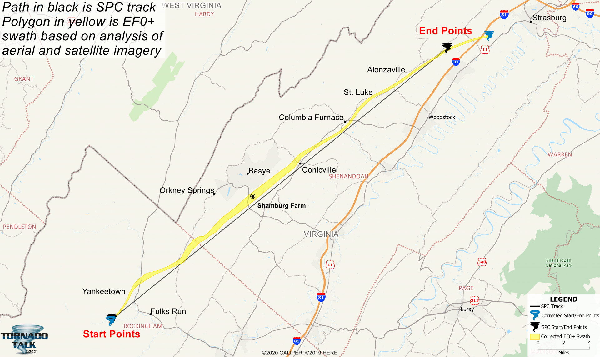
Note: Exact tornado path may not be straight and/or continuous.
Summary
During the early morning hours of April 28, 2011, five tornadoes ripped across the Shenandoah Valley. This summary looks at the strongest, an EF2, that snaked along a 37.6 mile path across Rockingham and Shenandoah Counties. It caused heavy damage near Basye and injured two people.
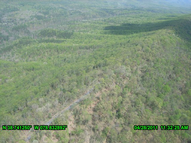
The tornado began 3.11 miles WSW of Fulks Run around 2:12 am EDT. The weak twister moved north-northeast, passing just east of Yankeetown, causing minor tree damage and destroying a cattle shed. It veered toward the northeast and ascended Church Mountain, 3.17 miles north of Fulks Run. The funnel crossed over the crest of the mountain at the height of 2,628 feet. The tornado reached a width of 880 yards (½ mile) as it crossed the Rockingham/Shenandoah County border. The damage along the 9.37 mile path in Rockingham County was mostly confined to sporadically snapped and uprooted trees (EF0).
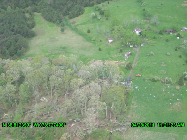
Aerial photo showing minor tree damage along the Rockingham/Shenandoah County border (Virginia Department of Emergency Management).
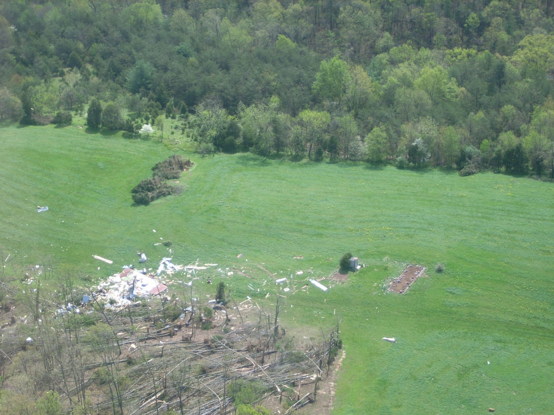
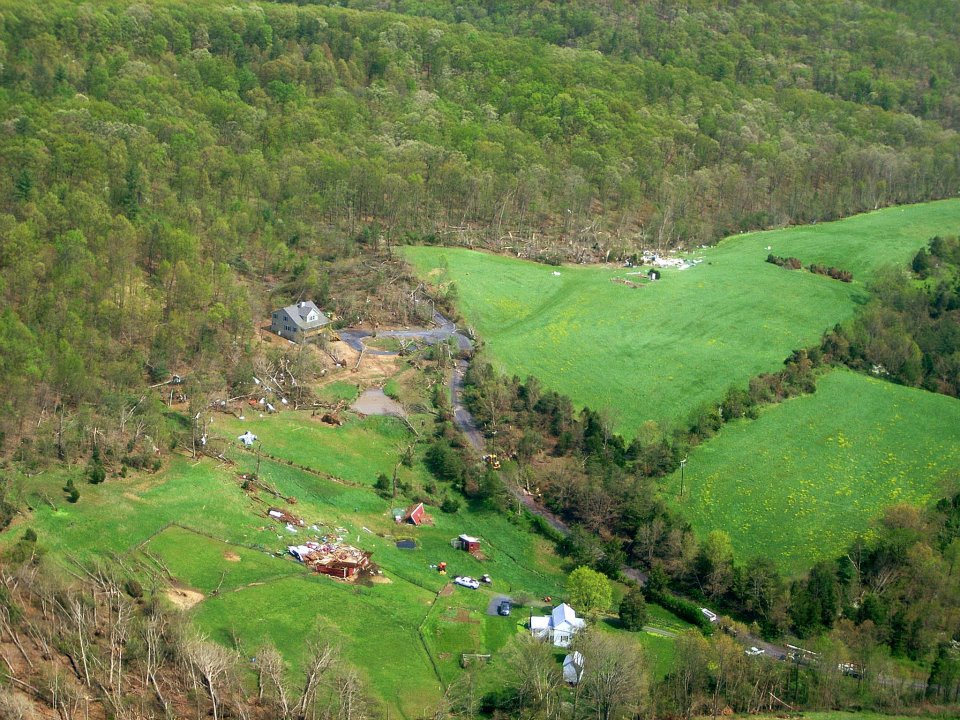
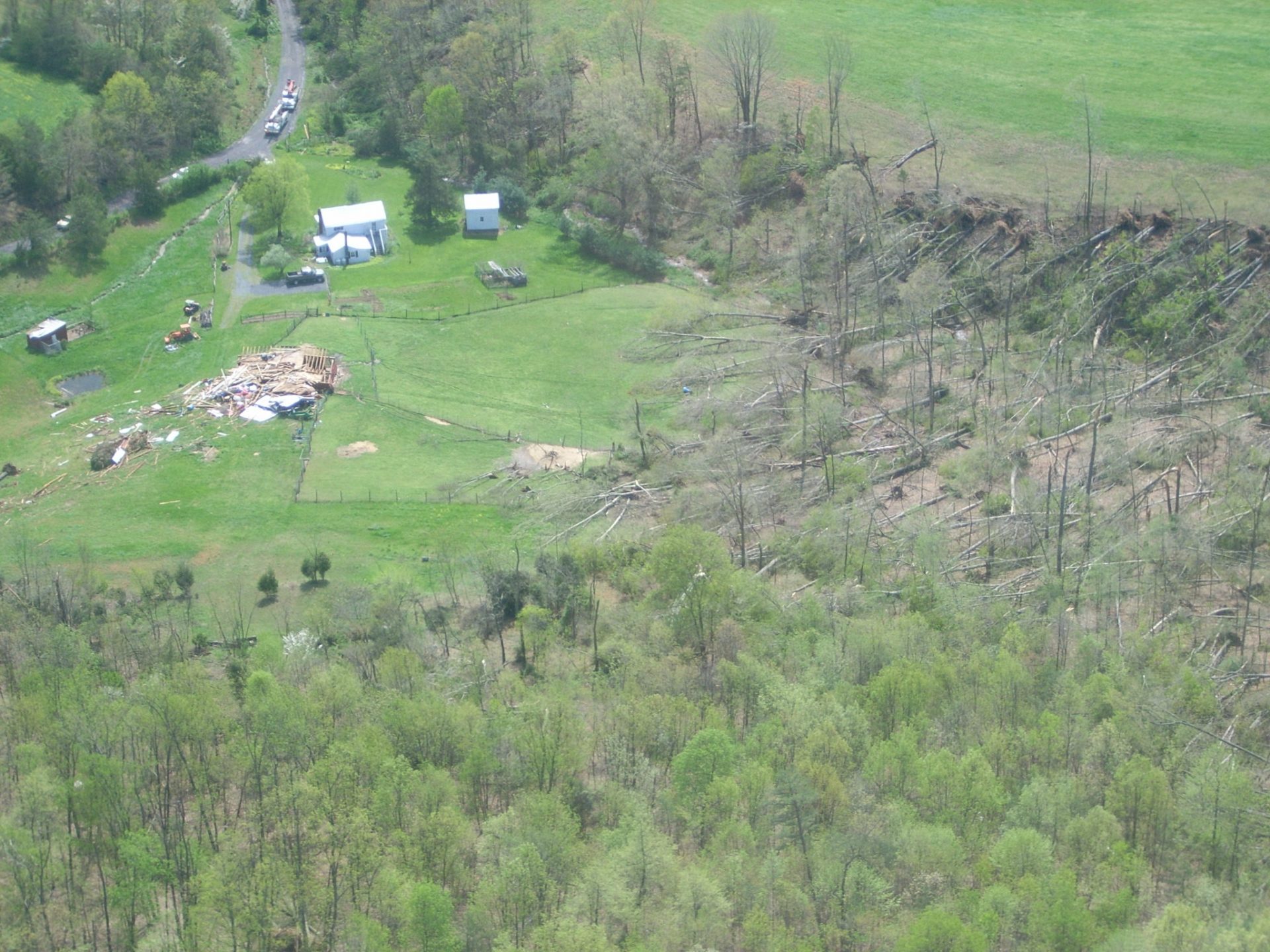
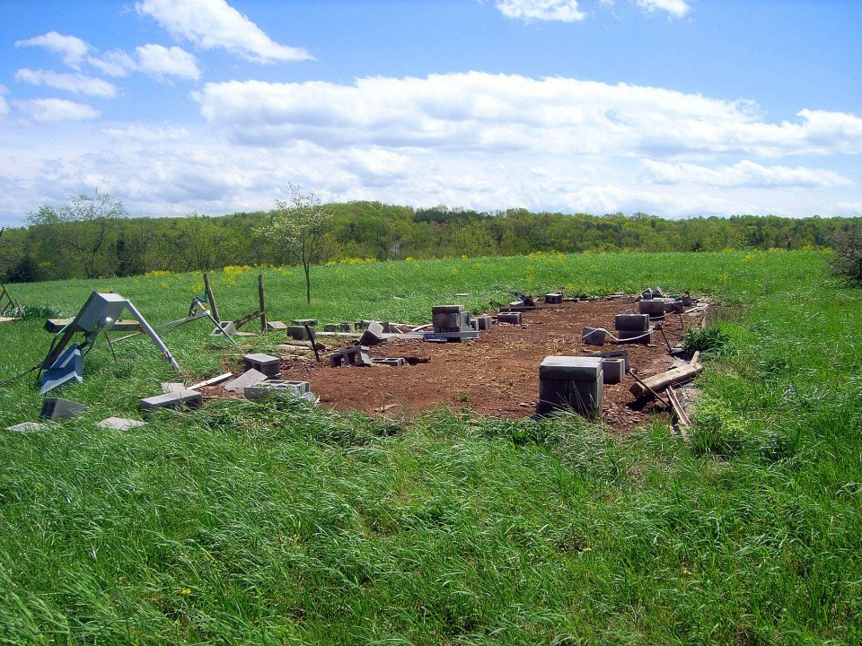
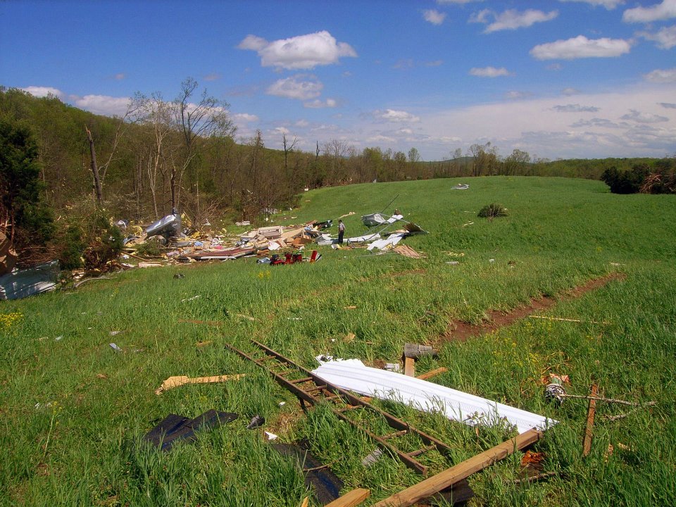
The tornado strengthened to an EF2 SW of Orkney Springs in Shenandoah County. Along Hepner Road, a barn was destroyed, and a mobile home was leveled. The trailer was vaulted into the air and smashed into the ground 40 yards away, leaving an impact mark, then continued to tumble for 30 more yards into a woodline. There was significant tree damage in the wooded areas east of Orkney Springs.
The mobile home along Hepner Road that was destroyed (Shenandoah County Dept of Fire and Rescue).
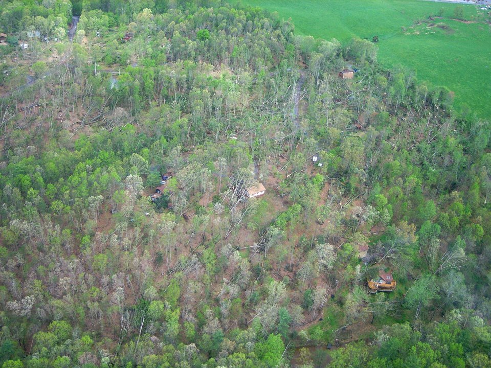
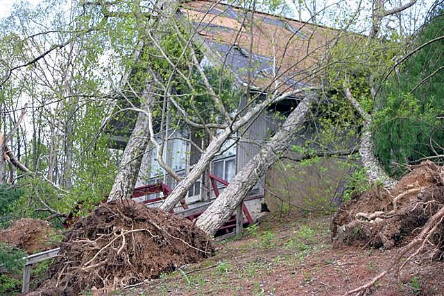
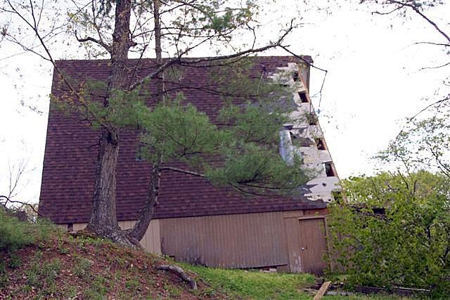
The tornado crossed Route 263, two miles SE of Basye, and moved into the Ski and Hunt Subdivision. It reached peak intensity with estimated wind speeds at 130 mph. Sixteen homes sustained varying degrees of damage.
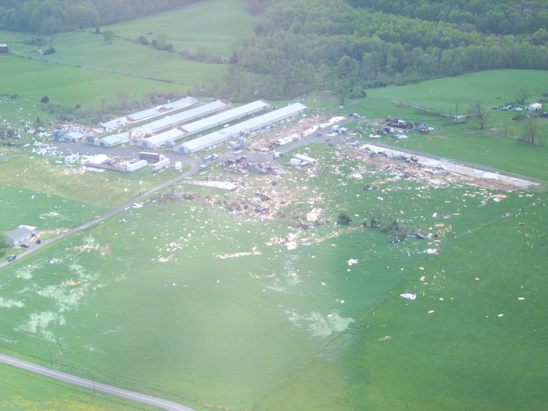
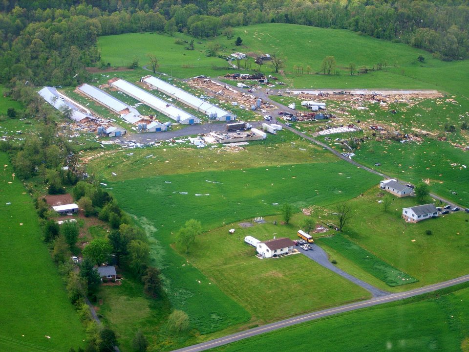
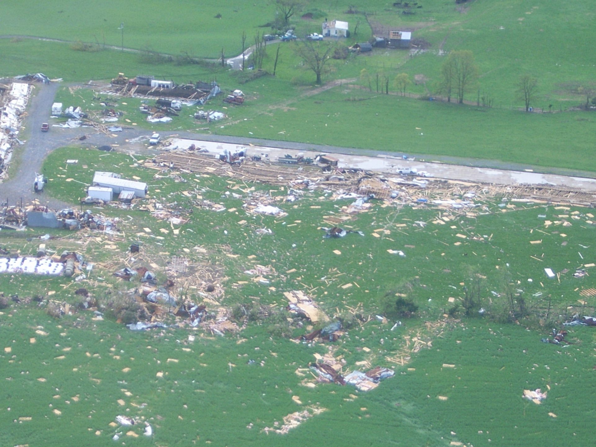
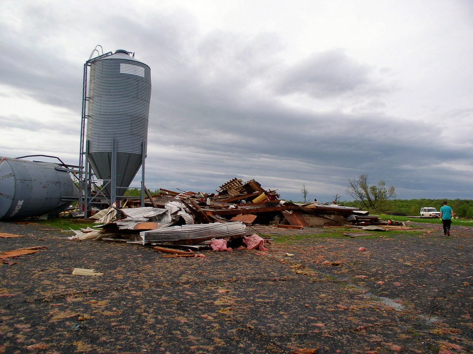
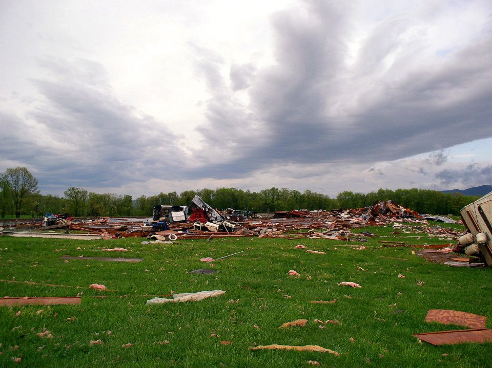
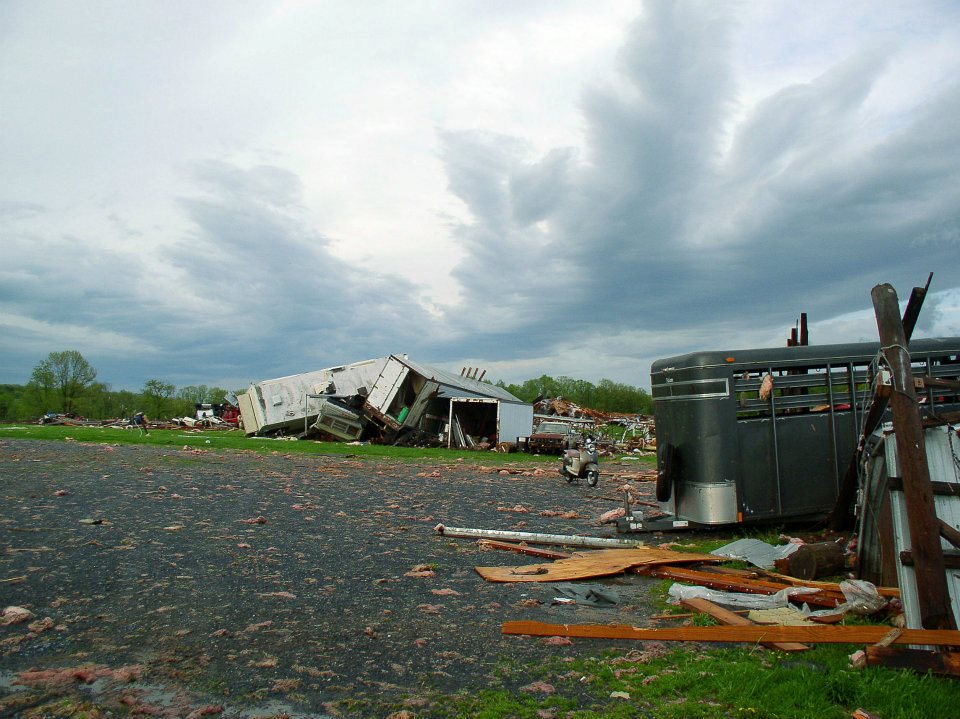
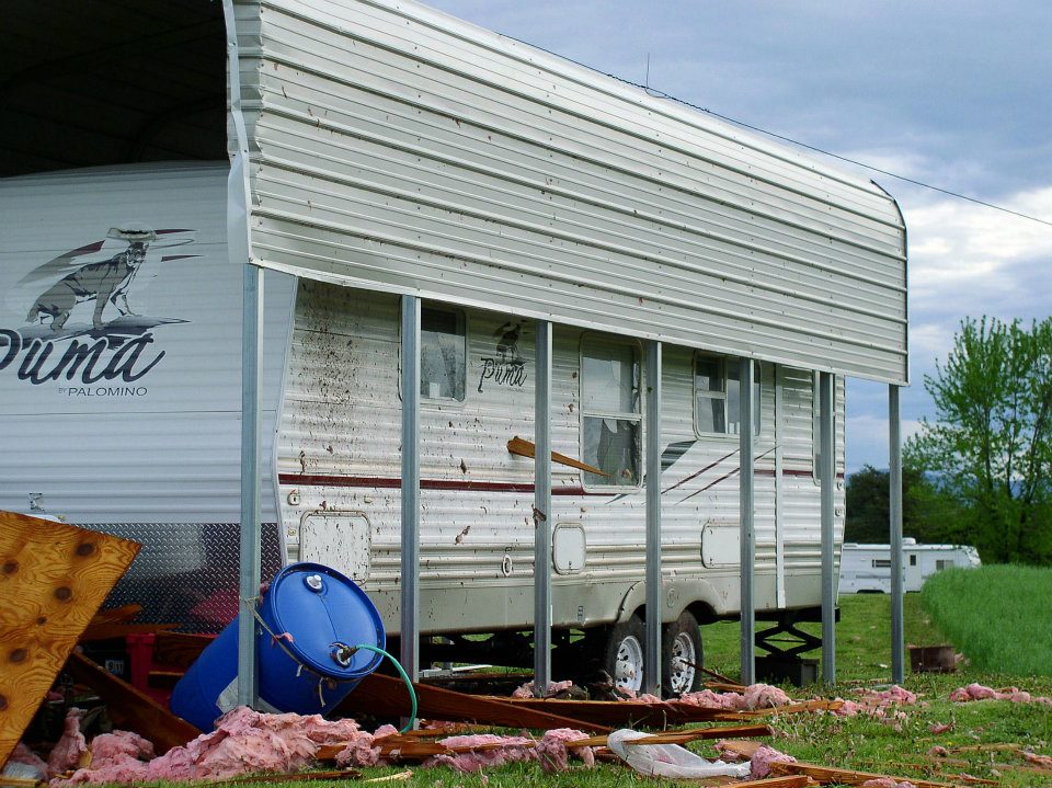
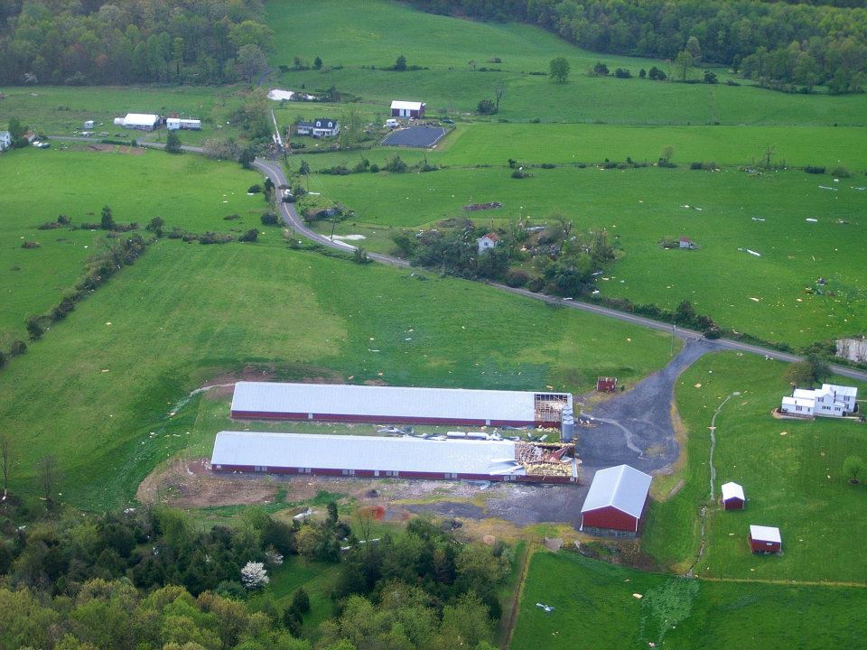
The Shamburg Poultry Farm, on Kelley Road, was hard hit. Several barns and chicken houses were destroyed, two of which were swept away. Thousands of chickens were killed. A piece of timber was impaled through the wall of a travel trailer. Buck Hirsh reported to WHSV-TV that they still find pieces of debris in the fields to this day, ten years after the tornado. A half-ton piece of industrial equipment was thrown 200 yards and a pickup truck was rolled over. The community came together to help clean up the farm, and the Shamburgs fully rebuilt.
An aerial view of the Shamburg Farm (Shenandoah County Dept of Fire and Rescue)
A special thank you goes out to Aubrey Urbanowicz, Chief Meteorologist of WHSV-TV in Harrisonburg, VA. She compiled an excellent video detailing the damage at the Shamburg farm, which can be seen below.
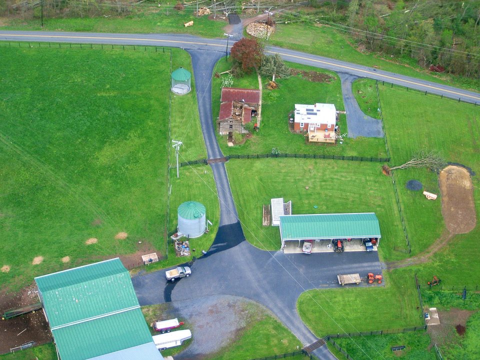
The Polk Chicken Farm sustained minor damage. The ends of two chicken houses lost part of their roof panels. The tornado slowly weakened as it followed Kelly Road and moved across Dearhead Road toward Conicville. Homes and barns sustained minor roof damage, and pockets of trees were blown down.
The tornado weakened further to an EF0 as it approached Conicville. It produced sporadic tree damage for the next 19 miles as it passed by Columbia Furnace, St. Luke, and Alonzaville. The twister dissipated 3.41 miles SW of Strasburg.
Photos in Chronological Order
Hepner Road (Shenandoah County Dept of Fire and Rescue).
Aerial view of the destroyed barn on Hepner Road (Shenandoah County Dept of Fire and Rescue).
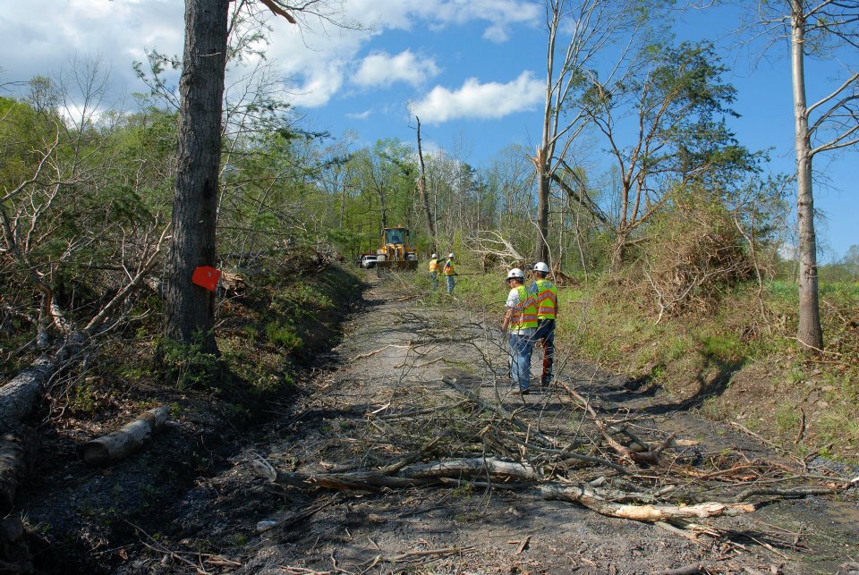
Crews cleaning up the downed trees on Hepner Road (Shenandoah County Dept of Fire and Rescue).
The foundation of the mobile home that was destroyed on Hempner Road (Shenandoah County Dept of Fire and Rescue).
In the foreground, you can see the gouge mark from where the trailer hit the ground. In the background, you can see the trailer’s remains. (Shenandoah County Dept of Fire and Rescue).
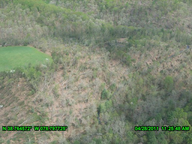
Significant tree damage about ¼ mile northeast of the destroyed trailer (Virginia Department of Emergency Management).
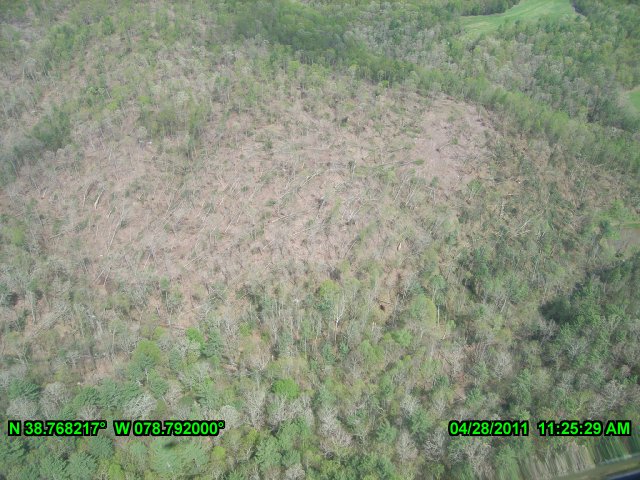
Severe tree devastation ¾ of a mile northeast of the destroyed trailer. (Virginia Department of Emergency Management).
An aerial photo of the Ski and Hunt Subdivision (Shenandoah County Dept of Fire and Rescue).
Trees down on a house in the Ski and Hunt Subdivision (Shenandoah County Dept of Fire and Rescue).
A house damaged in the Ski and Hunt Subdivision (Shenandoah County Dept of Fire and Rescue).
The Shamburg Farm (Shenandoah County Dept of Fire and Rescue).
A chicken house on the Shamburg Farm that was swept away (Shenandoah County Dept of Fire and Rescue).
A ground-level photo of a destroyed chicken house on the Shamburg Farm (Shenandoah County Dept of Fire and Rescue).
A ground-level shot of a destroyed chicken house on the Shamburg Farm (Shenandoah County Dept of Fire and Rescue).
Tractor-trailers that were tossed together at the Shamburg Farm (Shenandoah County Dept of Fire and Rescue).
A piece of timber that was pierced into the side of a travel trailer on the Shamburg Farm (Shenandoah County Dept of Fire and Rescue).
Damage on the Polk Farm (Shenandoah County Dept of Fire and Rescue).
Minor roof damage to a house and barn on Kelly Road (Shenandoah County Dept of Fire and Rescue).
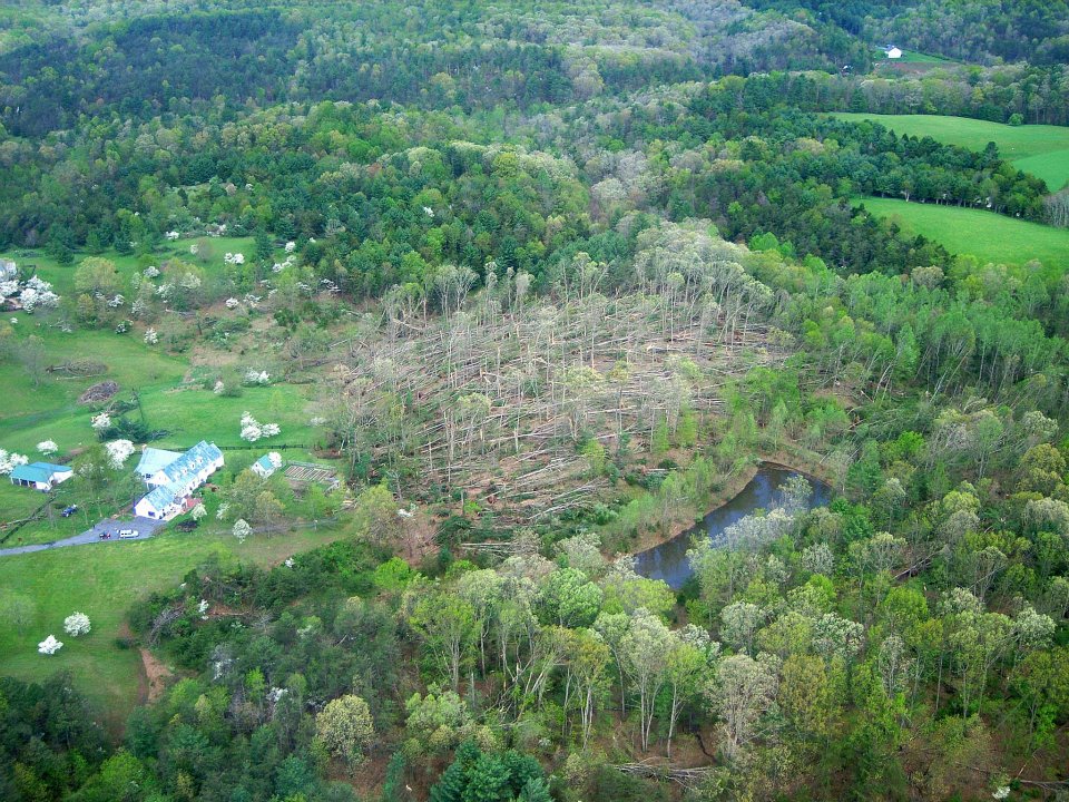
The last area of significant (EF2) damage. A pocket of severe blowdown can be seen (Shenandoah County Dept of Fire and Rescue).
Minor damage just off of Deerhead Road (Virginia Department of Emergency Management).
Discrepancies:
We gathered information for this event from the SPC and NCDC Databases, the April 2011 Storm Data Publication (SDP), the NWS Sterling Summary, and analysis of satellite and aerial imagery and found the following differences:
Path Length:
SPC/NCDC/SDP/NWS list a 33.2 mile path length.
Analysis of satellite and aerial imagery found a 37.6 mile path length.
Path Width:
SPC/NCDC/SDP/NWS list a 400-yard path width.
Analysis of satellite and aerial imagery shows a 1,020-yard path width.
DeLEA, P 2011, ‘Storms Batter Valley’, Daily News-Record (Harrisonburg, VA), 29 Apr, p. A1, (online NewsBank).
Questions or comments about this summary? Contact us here!
Note: There are some images/videos in our summaries that were licensed to us to be used only on this website. If you would like to use an image/video in your project or blog, please contact us and we will grant permission if possible.
Newspaper clips are embedded via newspapers.com. Please see their terms and conditions.
————————————————
Would you like to see more summaries like this one? Support Tornado Talk on Patreon! Become a Patron!
0 Comments